Drones in Protected Areas: how can they help?
pixabay
Drones are taking the world by storm. Although at first, it might seem like they are made solely for entertainment purposes, these unmanned aerial vehicles are proving to be much more. Besides providing astonishing images of your Park, they can be used to help technicians in their daily work in monitoring protected areas.
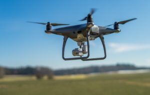
image from pixabay
Many protected areas authorities are currently experiencing economic difficulties which hamper the good undertaking of the many tasks they have in order to ensure good management of the protected area. Drones can therefore not only be of help, but also reduce costs and improve effectiveness.
This new technology has integrated the modern park management and is used for multiple purposes (monitoring, mapping, remote sensing, photography, technical interventions in inaccessible areas…), offering numerous interesting possibilities.
They allow scientists to reach places that were previously off limits as they were either too remote, too dangerous or too time consuming to explore. They can cover large areas of ground in great detail from a completely different perspective – and as fast as ever.
The list of the ways they can be used is really long – they are getting very precise and lately, they have even been used to plant trees!
A professional insight
Patrick Ribeiro, founder and CEO of OpenForests gave us an even better insight into all the possibilities drones can bring to those who decide to use it professionally.
∼ The drone itself doesn’t do anything. It depends on the sensor you have on the drone.
In the conservations areas, the most common ones are thermal sensors which enable you to fly at night or early mornings, and use the drone for animal observation.
There is also mapping. It is done by overflying the certain area, making individual photos and, in the end, with the help of the software, creating a 3D model. It can be used for different analysis such as forest growth or even illegal logging.
The most extreme option is laser scanning. It enables you to see the entire forest structure, and not just the surface of the landscape. However, this is mainly used for scientific purposes as it involves high cots.
Using the drone and gathering the data is one thing, processing and analysing data to extract the information is something else.
Keeping that in mind, it is very important to have a good and professional team of people who don’t necessarily have to work in every protected area individually, but can instead cover entire regions, or towns, depending on the specific country.
Just in case you are still skeptical about them, take a look at all the ways they can help specific protected area.
What can they do?
If you are trying to find out what drones can specifically do in protected area, take a look at Collserola Natural Park in Barcelona. Here is the example of all the different things they are using drones for:
1. Maintenance of furniture and pieces of equipment
The drone is periodically used to take pictures from the equipment and furniture scattered all over the park and to make topographic plans from different picnic and leisure areas. In this way, the Protected Area authority can detect for example when a piece of furniture needs to be fixed or repaired.
2. Forest fires
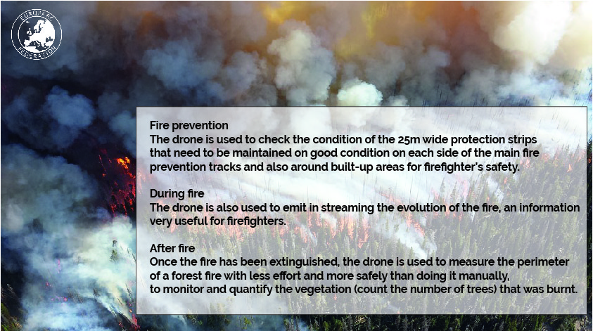
3. Power lines
The drone is being used to calculate the distance from trees to the power line in order to maintain in good condition the safety trip between power lines and nearest trees.
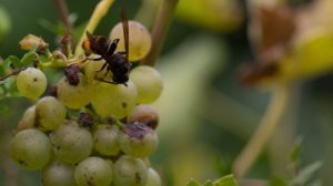
4. Agriculture management
The drone is used to do topographic maps in 3D and check for shady areas. This will help to improve grape crops by detecting where it is best to plan what variety.
pixabay
The drone is also been used to detect nests of Asian hornets Vespa velutina – an invasive alien species that is badly affecting beehives and grape crops – in order to eliminate them. To do that, a thermal camera is coupled to the drone since the leaves of the forest trees hampers the use of normal cameras.
5. Cultural heritage
The drone is used to take 3D pictures from the built elements present in the park.
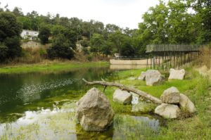
Collserola nature park
Pantà de Vallvidrera
Autor Robert Peña
6. Vegetation monitoring
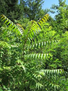
The drone can also be used to monitor the presence of other invasive species, such as Ailanthus altissima
pixabay
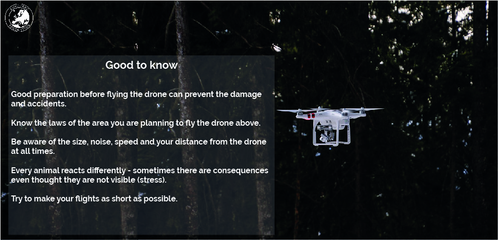
One of the key question for PA managers, scientists and nature conservation practitioners is whether there are more positive or negative impacts resulting from the use of drones for precise conservation tasks. There are many other potential uses of drones in Collserola Natural Park linked with public use such as monitoring massive events or, with fauna, remote sensing. However, these need careful development and planning. Such aspects as permits requirement to record people gatherings and disturbance to fauna need to be considered.
If you would like to get more information and tips on drone use visit Alparc page with conference presentations on Unmanned Aircraft Systems (Drones) in protected areas.
Check also our article about the different uses of drones for nature conservation.
Are you using drones in your Park and Conservation projects?
Do you have any experience you would like to share with us? Are there specific law constraints on the use of drones in your park? Let us know your thoughts, we are preparing a webinar on the use of drones and would like to hear from you. Please send your feedback to s.grego @ europarc.org