New members from Switzerland and France
Landschaftspark Binntal Photo Brigitte Wolf
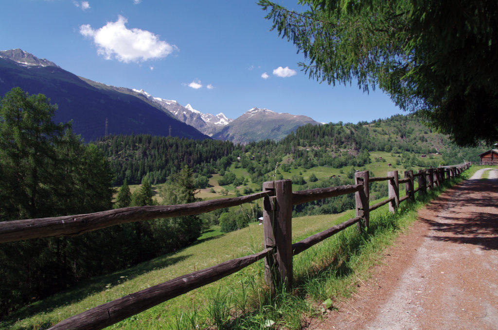
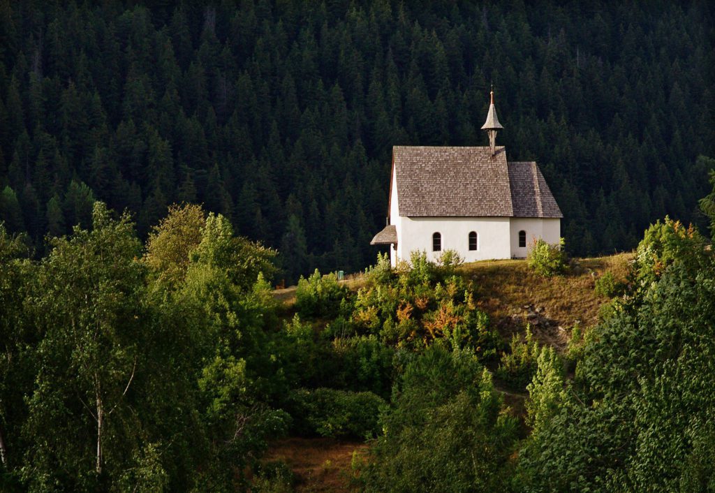
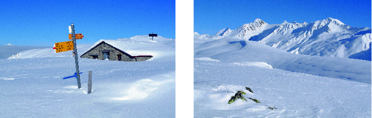
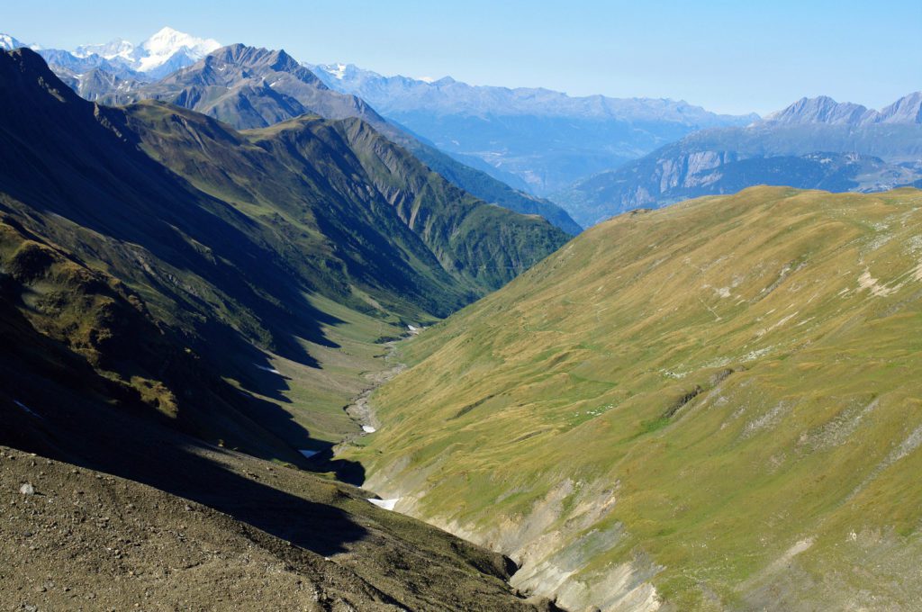
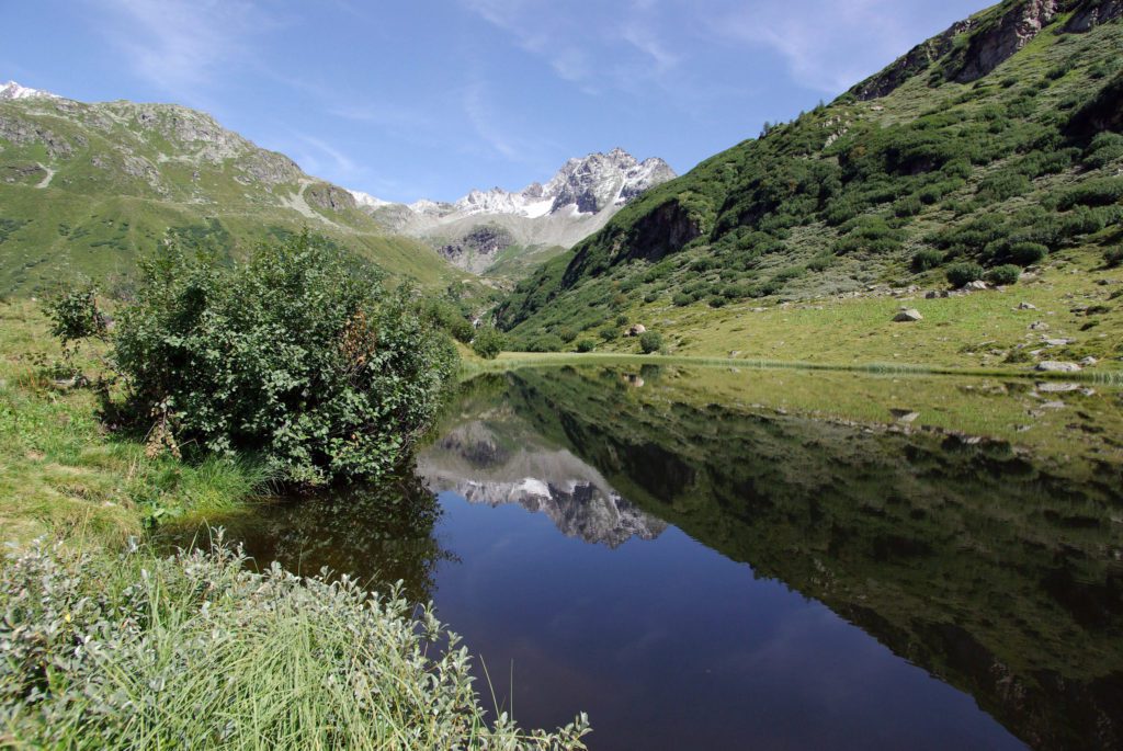
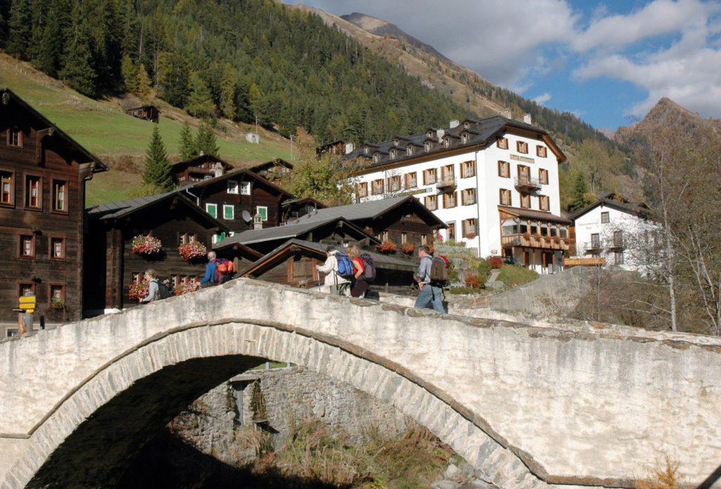
Binntal Nature Park
Landschaftspark Binntal – Photo Brigitte Wolf
Binntal Nature Park is a regional platform for the conservation of the rich natural and cultural heritage, ensuring sustainable economic activities and strengthening the cohesion of the population.
Landschaftspark Binntal – Photo Brigitte Wolf
Binntal Nature Park has been the first protected area in the entire Canton of Valais that was recognized as “regional nature park of national importance” by the Swiss Government in the year 2011.
Landschaftspark Binntal
Photo Brigitte Wolf
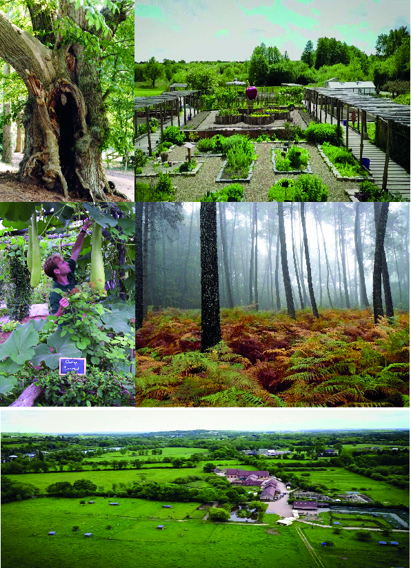
Binntal is known as “the valley of hidden treasures” and for its wealth of geological resources. Nature has made the Binn valley one of the regions of the Alps richest in mineral deposits. Up until now, 273 different minerals have been discovered, 23 are unique in the world.
Landschaftspark Binntal
Photo Brigitte Wolf
Flora and fauna are utterly diverse, too. 184 animal and plant species that are on the red list have been found in Binntal Nature Park. The diversity of animals, plants, and habitats is astonishing: low-moor bogs, dry neglected grassland, dark spruce forests, barren alpine pastures, lush meadows, glacier forelands, sparse pine forests, dark mountain lakes, rock steppes, old fields, alpine meadows and much more, form a varied mosaic.
Landschaftspark Binntal
Photo Brigitte Wolf
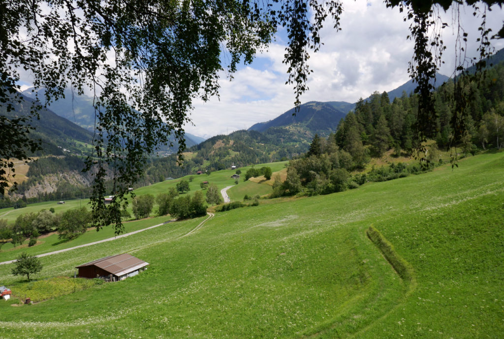
Lynchets, hay meadows, alpine pastures, paths, dry-stone walls, stables, barns, and alpine cabins shape the traditional cultural landscape and bear witness to the diligence and hard work of past generations.
Landschaftspark Binntal
Photo Brigitte Wolf
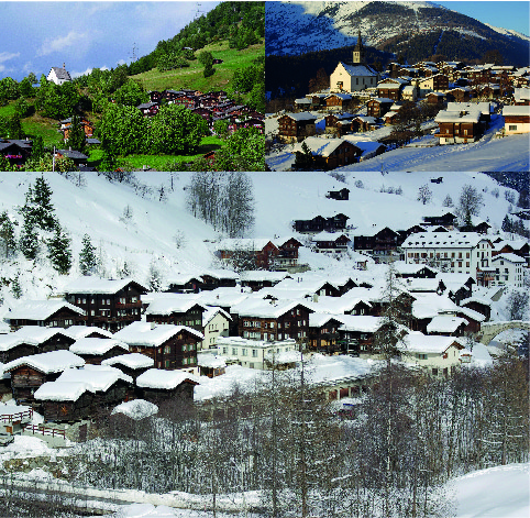
The villages and hamlets with their dark houses made of sun-kissed larch wood are so beautiful and well preserved that they were incorporated into the Federal Inventory of Objects of National Importance.
Landschaftspark Binntal Brigitte Wolf
Since the start of the second part of the 20th century, the regional economy has been undergoing a long-lasting structural change from an agrarian to a service society including a shift from jobs in agriculture to jobs in the service sector.
Landschaftspark Binntal Photo Brigitte Wolf
During this transformation many jobs have been lost in the areas of craftsmanship and trade. Some of them could be replaced due to the growth of the service industry, which was especially induced through tourism.
Landschaftspark Binntal
Photo Brigitte Wolf
The effects that urbanization and globalization had on the agglomerations and depletion of the peripheral regions, which are the results of the concentration of growth, have been noticeable since the mid-90s.
Landschaftspark Binntal
Photo Brigitte Wolf
Le mans metropole arche de la nature
Le mans metropole arche Photo crédits Ville du Mans
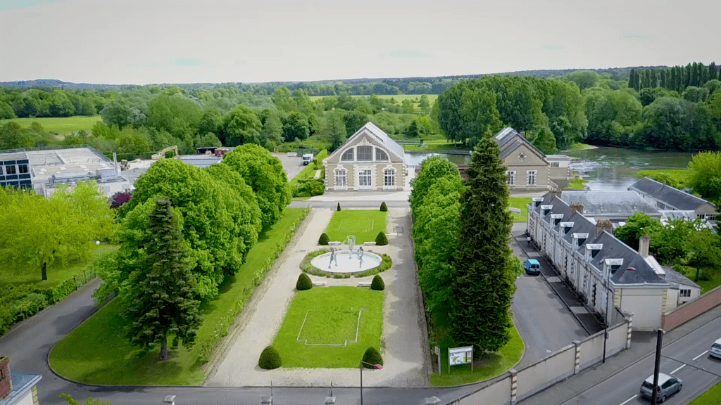
Located ten minutes from downtown Le Mans and a few meters from the Abbey of Epau, the Domaine de l’Arche de la Nature offers visitors a vast natural space that represents the main landscapes of the Sarthe region.
Photo crédits Ville du Mans
Along the way, visitors will discover the river, the forest, the countryside and can visit the Water House, the Forest House, and the Maison de la Prairie. The sports fields and playgrounds for children will delight young and old alike. In all, 450 hectares of nature are permanently open to the public.
Le mans metropole arche Photo crédits Ville du Mans
Le mans metropole arche Photo crédits Ville du Mans
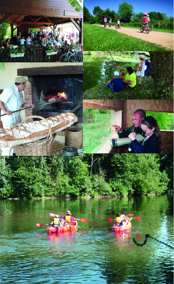
Since 1997, L’Arche de la Nature has been offering its many nature events. This natural space, created and managed by Le Mans Métropole, combines a spirit of discovery of nature with relaxation, particularly during major thematic popular festivals that welcome more than 70,000 visitors each year.
Le mans metropole arche Photo crédits Ville du Mans
Farmer’s Pride: your answers are needed!
Farmer’s Pride’) is a three year EU-funded project which started in November 2017.
Farmer’s Pride is a European Union funded project involving a diverse range of stakeholders. They are building a collaborative network for on-site conservation and sustainable use of Europe’s plant diversity for food, nutrition and economic security throughout the region. They are currently running 2 surveys, and your participation is needed!
Establishing a European Network
To help establish a new European network of conservation sites and stakeholders, they are reaching out to identify individuals and organizations involved or with an interest in the conservation of wild and cultivated plant genetic resources (crop wild relatives and traditional local varieties, or landraces), whether in farms, gardens, allotment sites, protected and non-protected areas.
The survey is relevant to all stakeholders, including agro-NGOs, civil society organizations, farmers and gardeners, nature conservation NGOs, plant breeding/seed companies, policy-makers, protected area managers, research institutes, seed/gene banks, and any related networks or other relevant organizations.
Take the short stakeholder survey.
The survey is available in Dutch, English, Finnish, French, German, Greek, Hungarian, Italian, Spanish and Turkish.
Strengthening in situ conservation
The Farmer’s Pride project is also responding to a call for action to enhance and strengthen in situ conservation and sustainable use of plant genetic resources (PGR) in Europe. The focus of the project is on conserving the diversity that exists in both wild and cultivated populations of species important for food, nutrition and economic security in the region.
The European Network for In Situ Conservation and Sustainable Use of Plant Genetic Resources will comprise a network of both stakeholders and sites across Europe. It will establish a mechanism for coordinated action on PGR conservation in situ in the region, with a view to ensuring that the diversity needed for continual crop enhancement and adaptation is available for future use.
Take part in the survey which seeks to identify ‘in situ’ conservation action for crop wild relatives.
It is aimed at those involved in practical conservation of protected areas and wild plant populations in non-protected areas.
They are interested in active conservation (involving direct actions on the target species, such as monitoring, habitat improvement, herbivory control, etc.) as opposed to passive conservation (conferred by the mere presence of the species in a protected area). By gathering this information, we intend to obtain an overview of existing in situ crop wild relative conservation actions and to develop a network showcase that illustrates best practices and examples for their conservation in Europe.
For more information visit: http://www.farmerspride.eu/
Drones in Protected Areas: how can they help?
pixabay
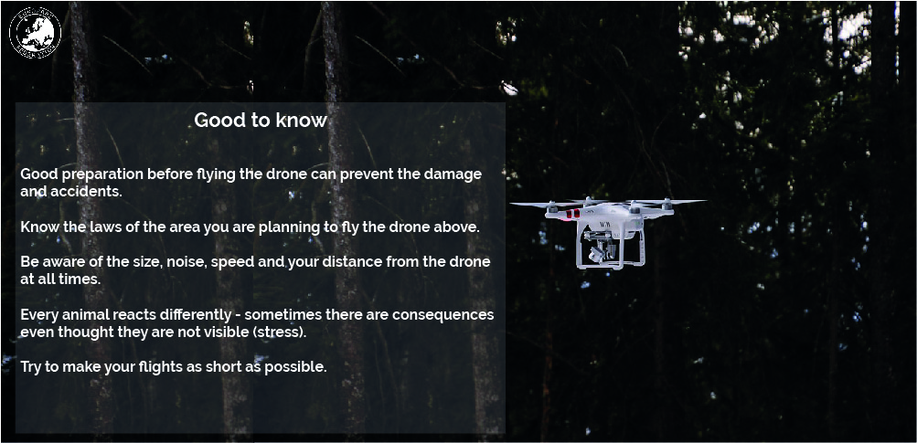
Drones are taking the world by storm. Although at first, it might seem like they are made solely for entertainment purposes, these unmanned aerial vehicles are proving to be much more. Besides providing astonishing images of your Park, they can be used to help technicians in their daily work in monitoring protected areas.
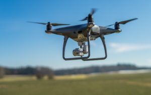
image from pixabay
Many protected areas authorities are currently experiencing economic difficulties which hamper the good undertaking of the many tasks they have in order to ensure good management of the protected area. Drones can therefore not only be of help, but also reduce costs and improve effectiveness.
This new technology has integrated the modern park management and is used for multiple purposes (monitoring, mapping, remote sensing, photography, technical interventions in inaccessible areas…), offering numerous interesting possibilities.
They allow scientists to reach places that were previously off limits as they were either too remote, too dangerous or too time consuming to explore. They can cover large areas of ground in great detail from a completely different perspective – and as fast as ever.
The list of the ways they can be used is really long – they are getting very precise and lately, they have even been used to plant trees!
A professional insight
Patrick Ribeiro, founder and CEO of OpenForests gave us an even better insight into all the possibilities drones can bring to those who decide to use it professionally.
∼ The drone itself doesn’t do anything. It depends on the sensor you have on the drone.
In the conservations areas, the most common ones are thermal sensors which enable you to fly at night or early mornings, and use the drone for animal observation.
There is also mapping. It is done by overflying the certain area, making individual photos and, in the end, with the help of the software, creating a 3D model. It can be used for different analysis such as forest growth or even illegal logging.
The most extreme option is laser scanning. It enables you to see the entire forest structure, and not just the surface of the landscape. However, this is mainly used for scientific purposes as it involves high cots.
Using the drone and gathering the data is one thing, processing and analysing data to extract the information is something else.
Keeping that in mind, it is very important to have a good and professional team of people who don’t necessarily have to work in every protected area individually, but can instead cover entire regions, or towns, depending on the specific country.
Just in case you are still skeptical about them, take a look at all the ways they can help specific protected area.
What can they do?
If you are trying to find out what drones can specifically do in protected area, take a look at Collserola Natural Park in Barcelona. Here is the example of all the different things they are using drones for:
1. Maintenance of furniture and pieces of equipment
The drone is periodically used to take pictures from the equipment and furniture scattered all over the park and to make topographic plans from different picnic and leisure areas. In this way, the Protected Area authority can detect for example when a piece of furniture needs to be fixed or repaired.
2. Forest fires
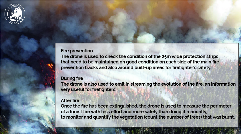
3. Power lines
The drone is being used to calculate the distance from trees to the power line in order to maintain in good condition the safety trip between power lines and nearest trees.
4. Agriculture management
The drone is used to do topographic maps in 3D and check for shady areas. This will help to improve grape crops by detecting where it is best to plan what variety.
pixabay
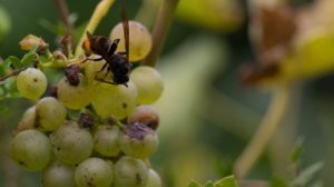
The drone is also been used to detect nests of Asian hornets Vespa velutina – an invasive alien species that is badly affecting beehives and grape crops – in order to eliminate them. To do that, a thermal camera is coupled to the drone since the leaves of the forest trees hampers the use of normal cameras.
5. Cultural heritage
The drone is used to take 3D pictures from the built elements present in the park.
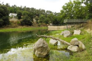
Collserola nature park
Pantà de Vallvidrera
Autor Robert Peña
6. Vegetation monitoring
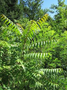
The drone can also be used to monitor the presence of other invasive species, such as Ailanthus altissima
pixabay
One of the key question for PA managers, scientists and nature conservation practitioners is whether there are more positive or negative impacts resulting from the use of drones for precise conservation tasks. There are many other potential uses of drones in Collserola Natural Park linked with public use such as monitoring massive events or, with fauna, remote sensing. However, these need careful development and planning. Such aspects as permits requirement to record people gatherings and disturbance to fauna need to be considered.
If you would like to get more information and tips on drone use visit Alparc page with conference presentations on Unmanned Aircraft Systems (Drones) in protected areas.
Check also our article about the different uses of drones for nature conservation.
Are you using drones in your Park and Conservation projects?
Do you have any experience you would like to share with us? Are there specific law constraints on the use of drones in your park? Let us know your thoughts, we are preparing a webinar on the use of drones and would like to hear from you. Please send your feedback to s.grego @ europarc.org
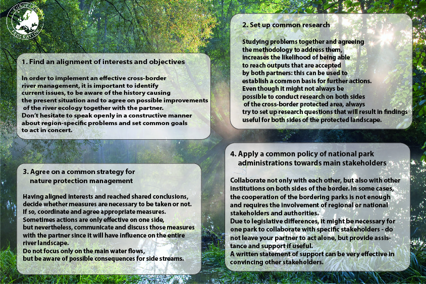
7 steps for effective cross-border management of river ecosystems
Österreich, Niederösterreich, Nationalpark, Thayatal, Fluss Thaya
How to protect nature across borders?
Ever since humans started to settle, they have erected borders to protected land, property and territory. However, nature does not recognise man-made borders… Protecting and living alongside nature means following nature’s design. Working across borders is fundamental for the effective conservation of shared nature and landscapes, but it is also a means to achieve regional development, whilst promoting mutual understanding and international peace.
To encourage dialogue and cooperation between Protected Areas which share common natural resources, the EUROPARC Federation developed the Transboundary Parks Programme – Following Nature’s Design. It is the only method in Europe to analyse the progress of transboundary cooperation while supporting the growth of a network of professionals working in this field.
7 steps for effective cross-border management of river ecosystems
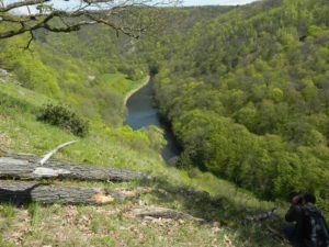
The cross-border cooperation between the National Parks Thayatal and Podyjí is vital for the protection of the canyon-like valley of the border river Thaya between Austria and the Czech Republic. The basic principle of this cooperation is to optimize the impact of conservation management by combining methods and management tools.
 Over the past 20 years, the parks’ administrations have been working together in research and monitoring projects, forest management, regulation of game stocks, and educational visitor programmes. Their continuous efforts to find the best solutions for the complex management of the Thaya river ecosystem is proving highly effective. Here is what we can learn from their experience:
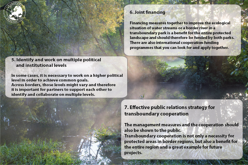
The Podyjí National Park was created shortly after the fall of the Iron Curtain in 1991, inspiring nature conservationists to start a debate about protecting the area on the Austrian side of border. Nine years later, the Thayatal National Park was finally established. Since then, both national parks have been working together to achieve the best possible protection of this natural habitat and have been following the EUROPARC Transboundary Parks Programme in 2007.
TransParcNet Meeting 2018 © Stefania Petrosillo
In 2018, Thayatal and Podyjí hosted the TransParcNet meeting focused on the topic “Bridges over troubled water – Nature protection of river landscapes”. Read the outcomes and access the presentations of the meeting here .
Podyi National Park
The TransParcNet
With the TransParcNet, the network of certified Transboundary Parks, we provide opportunities to build-up expertise in cross-border cooperation based on the exchange of experience, tools, and best practice. By following the EUROPARC standards of transboundary cooperation, parks aspire to be models of sustainable development through the effective protection of Europe’s natural and cultural heritage.
Since the Basic Standards evaluation system of the programme was launched in 2003, 23 European Protected Areas have been successfully certified as 10 Transboundary Parks.
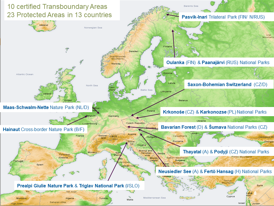
EUROPARC is looking for new Transboundary Parks across Europe, willing to improve their cooperation and to share their experience within the TransParcNet. We are most glad to welcome you!
Learn more about the programme here.
![]()
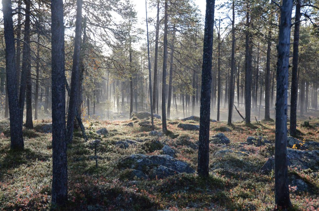
Pasvik-Inari Trilateral Park, by Ben Arne Sotkajcervi
You found this topic interesting? To find more articles like this one, download the new edition of the EUROPARC Journal Protected Areas In-Sight with a special focus on youth involvement Parks – available in english, german and french!